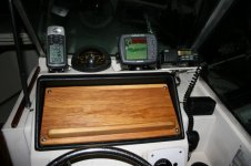
Ive been thinking about buying a small handheld gps to use on my V and maybe traveling on the road . Ive found a few on ebay fairly cheap. The lowrance ifinder GO is really cheap but dont know if it will serve my needs. As for marine use , I probley only need it to go to the Checapeake Light tower and maybe to the Gulf Stream on a flat calm day. I just need one to track my course there and get me back. what do you all suggest?

Wellcraft, V20 and Steplift remain the property of the Wellcraft Company
Install the app
How to install the app on iOS
Follow along with the video below to see how to install our site as a web app on your home screen.
Note: This feature may not be available in some browsers.
You are using an out of date browser. It may not display this or other websites correctly.
You should upgrade or use an alternative browser.
You should upgrade or use an alternative browser.
GPS question
- Thread starter cfelton
- Start date
cterrebonne
God
Ive been thinking about buying a small handheld gps to use on my V and maybe traveling on the road . Ive found a few on ebay fairly cheap. The lowrance ifinder GO is really cheap but dont know if it will serve my needs. As for marine use , I probley only need it to go to the Checapeake Light tower and maybe to the Gulf Stream on a flat calm day. I just need one to track my course there and get me back. what do you all suggest?
as of right now i use a magellan meridian and i have gone on 65 mile plus trips into the gulf and im here to tell the tales.
THEFERMANATOR
God
I use a GARMIN GPSMAP 76. They have come down in price dramatically lately, and you can get the BLUECHART CD and upload detailed maps to it as well. I used mine on a 1300 mile voyage before with ZERO problems. The $3K STANDARD MARINE CHARTPLOTTER(1 year old) quit on us leaving BOSTON and bound for FLORIDA, so we used my GARMIN all the way back. Plus I used the basemaps on the drive up to BOSTON and back to FLORIDA in the truck.
macojoe
Administrator
Way back when I had a Garmin 12 hand held, no chart just numbers, and after going to were I wanted and putting ll numbers in I never never never got lost it was the balls!!
Garmin all the way!! That being said I got great deal on a standard Horizon this winter brand new, going to give it a shot, if I no like there will be a North Star on there faster then you can blink a eye!!
Garmin all the way!! That being said I got great deal on a standard Horizon this winter brand new, going to give it a shot, if I no like there will be a North Star on there faster then you can blink a eye!!
csvencer
Senior Member
GPSMAP 76 with bluecharts. You can get the unit new for $150 so I am sure you could find one for about a hundred bucks. That will get you what you need but I highly recommend getting the bluecharts to go with it. They are worth every penny. The nice thing is that you can do all your plotting, course layout, waypoints, etc on the computer then just download them to the unit.
-Svence
-Svence
greateastern
Member
Garmin Summit HC it is a hand held that works in your car and with the blue chart on the boat, or in the trail it will track you as well. So if you know were you are going in the day time, it will bring you back home in the night. works off batt. It is a true boater friend.
jjjtronics
Junior Member
randlemanboater
God
I have a Garmin GPS-V. It works great for me.
I use it in the car, on the boat, on my motorcycle, and use it handheld for Geocaching.
The one thing I don't like about it is that it only holds 19mb of detailed maps so I have to reload each time I drive in a different direction.
On the boat it works perfect.
I made a bracket for it for the boat that doesn't shake.
They don't make them anymore but you can find them on ebay for cheep.
